Showing posts with label Hidden Gems. Show all posts

Monday, 19 October 2015

Shakespeare in the Dog House!

Sorry. I just can't resist a punning title. In fact, this has little to do with Shakespeare, and nothing  to do with dog houses - real or metaphorical.

In fact, what I want to talk about this time is the visit we made to St. Dogmael's Abbey during our recent foray into South Wales. Sorry it's taken so long to post - six weeks or so since the last instalment - but for some reason I found this difficult to write. It was such an unusual place I found it hard to commit the experience to words with any kind of accuracy. I'm still not sure I've done it justice, but there's a limit to how long you can spend on something, even in the persuit of perfection!

The wonderful hidden gem of a place sits about a mile to the west of Cardigan, on the opposite side of the river Teifi (it's a Welsh name, and so is pronounced Tey-vi). It's one of those places, not hard to find, but easy enough to miss if you don't know it's there. Don't make that mistake. If your travels take you to the Cardigan area this is one little gem you absolutely don't want to miss!

The Abbey whose ruins can be seen today has Norman foundations, but just how long the site had been a place of Christian Worship at that point is unclear. Certainly there is a charter from the twelfth century which refers to "the ancient church of St Dogfael", suggesting that it had been used by Christians for some considerable time before the conquest.

St Dogmael - or "Dogfael", medievel spelling seems to have been more or less optional - himself is believed to have been doing his thing in the sixth century. That of course puts him in that portion of history after the departure of the Romans from these shores that some are pleased to call the "dark ages". Modern archaeologists and historians will tell you that the dark ages were in fact anything but dark, the problem is the scarcity of any kind of documentation from the period. We know very little for certain about what went on in the  sixth century, and St Dogmael is no exception.

The guide book* tells us that the saint was the son of a man called "Ithel ap Ceredig ap Cunedda Weledig". Apparently this would mean he was descended from the founder of the royal family of Gwynned. It is also claimed that he was the cousin of St. David - which in Wales is a pretty good claim to fame! Anyway - suffice to say there's deep history there, but as I said, the ruins you can see today are Norman in origin, and a fine set of ruins they are.

Not perhaps as big and imposing as the famed ruins at Fountains Abbey in North Yorkshire, but still an interesting example of a smaller monastic house.

Looking through this window you can see the churchyard of the adjacent parish church - which of course means that a part of the site at least is still in use for its original purpose after at least 1,400 years. That's rather impressive when you think about it...

Enough of the walls and foundations are visible for you to get a sense of what the abbey would have been like in its heyday, before Henry VIII's break from Rome and subsequent dissolution of the monastaries pretty much brought an end to the monastic way of life not just here, but more or less everywhere else on this sceptered isle.

Since then the Abbey buildings have served the local community in the way ruins and disused buildings have always done - as an aesthetic feature and a handy quarry. I'd be highly surprised if several of the local houses didn't contain stone originally cut and dressed for the abbey. It's fitting really. Monastic houses were supposed to serve the community** so it seems reasonable that the place continued to do so long after the monks were gone.

These days the ruins are a picturesque place to visit, but also a pleasant backdrop. The day we were there was intended to be the opening night of an outdoor production of Shakespeare's last play, The Tempest. 


This is why there were folding seats under a blue tarpaulin and a bunch of pretend masts and sails about the place when we were there.

Of course, we were there during the diluvian summer of 2015, so the little tents housing the production's technical equipment were filled with people looking at weather reports and trying to decide whether they'd need to cancel the performance. So far as recall the skies remained clear, so I presume the performances went ahead, although I haven't been able to find a single review online, so I can't be sure...

There is more to this little gem than just the Abbey, however. Pulling in to the little car park our attention was first taken by the old mill pond which sits adjacent. It's not very big, surrounded by large trees which offered some dappled shade against the surprisingly strong sun - this being one of the few days on our Welsh trip we'd actually seen the thing. It was very pretty indeed, and offered a home to some of the most remarkable ducks we've ever seen.

I'm no poultry expert, and have no idea what breed they might have been, but they were much bigger than your average millpond mallard, and the same sort of iridescent rainbow of "black" plumage one might normally associate with a starling's wing.

They were quite the attraction, with many other visitors pausing to watch them waddle lazily about before settling down on the sparse grass verge between the road and the water.

We watched them for a while, before making our way into The Coach House Visitor Centre. In many ways this is a hidden gem attached to the hidden gem. You can actually get to the Abbey without going through The Coach House, but I can't imagine why you would.


Partly housed in (astonishingly enough) an old coach house, and partially in a modern extension, the Coach House Visitor Centre is part cafe, part information centre, part art gallery, part museum, part craft shop, you might expect the whole to become a disorganised mishmash. But far from it.

The cafe section occupies the new extension, with the art gracing the walls. A neat little information section takes up a corner at one end of the extension, with a museum featuring ancient stones from the Abbey in the ground floor of the old coach house.

Given that we left the Abbey ruins at around lunch o'clock, we decided to try the cafe out for size. It's fully licensed, and although I was driving Mrs Snail very much enjoyed a bottle of the locally brewed lager. Indeed, she enjoyed it so much that I bought a few bottles of the various local brews to take away - because I hate being left out!

The food was simple - it's a cafe, not a restaurant, after all - but well presented. We both opted for cheese and ham panninis, which were served with a salad garnish and were pretty good. The service was swift and pleasant and the atmosphere was laid back and convivial. We very much enjoyed the place and should we ever be in the area again (and given that it's not that far from Grandma Snail's*** house, we will be) we'll certainly be popping in for coffee and a bite to eat.

It's a fascinating little corner of Cardigan, and I'd argue strongly that no visit to South Wales would be complete without dropping in.


*A very reasonably priced publication I should say - for a mere £2.95 it gives detailed information about the Abbey and it's history, as well as the Pentre Ifan Burial Chamber we explored in the last post and Cilgerran Castle, about which more next week. Back over the border English Heritage would have made three separate guidebooks and charged four quid for each of them! Just another brilliant thing about Wales...

** They often didn't - quite the opposite in fact, but that was the original intention...

***Yes, I know I said I wouldn't call her that, but right now I'm in Yorkshire and she's in Wales. Besides, she is a Grandma, so I figure I'll risk it...

Friday, 4 September 2015

Ironing a few things out.

Here at Snail Towers we love a bit of history - and we particularly love the older stuff - the Mesolithic through to the Iron Age. One of the first things we did on arriving in South Wales was head off to discover what the area had to offer. There was a pretty obvious first port of call - the famed Pentre Ifan burial chamber which sits atop a hill in the heart of the Pembrokeshire National Park. Of course, we did have to find it first - and that was not an entirely stright forward proposition.  

You see, our Neolithic ancestors were pretty sophisticated whne it came to balancing rocks on top of each other - as anyone who has ever seen Stone Henge will happily attest. They were, however, less than thoughtful in their choice of location for their stone circles and burial chambers. For every Stonehenge and Silbury Hill (handily located by the side of the A303 and A4 respectively) there's a Twelve Apostles, a hefty walk from the road across Ilkley Moor, or Pentre Ifan - which is, I grant you, only a very short walk from the road, but finding the right bit of the road or even finding right road, well. That was more difficult...

I'm sure there is a perfectly straightforward route from the main road, through the series of single track lanes that take you up to the top of the hill to the monument. It's probably beautifully signposted.

All I'm saying is that we didn't find it - and I have to say we weren't the only ones. Having failed to find a brown sign pointing us off the main road, we struck off in what we hoped was the right direction armed with a map and Mrs Snail's famed sense of direction. On reflection, the map was a mistake. Mrs Snail's sense of direction is legendary - which is a good job, because I could get lost in my own living room. She can direct us to a place we've never been before without ever looking at a map - honestly, it's practically a super-power.

On reflection therefore, letting her have the map might have been a mistake. Mrs Snail is not good with maps.

I have to say, the fashion in Wales  - which is also big in the West Country - for having twisty turny single track roads with mahoosive hedges towering up on either side preventing you from getting your bearings doesn't help much. Frankly it's a pain in the arse, and it makes it really really hard to get your bearings.

As a result we found ourselves driving along seemingly endless corridors of green leaved walls with almost no reference points.

Eventually we came to a "T" junction. There were no signs to tell us which way to go but Mrs Snail had put down the map and was reasonably sure that we needed to go left. Just as we were about to another car approached from the right and screeched to a halt in the middle of the road. They paused for a moment looking at their map, and when we pulled out to the left, they followed us.

Eventually, after a couple of miles we finally hit on the smallest brown tourist sign we have ever seen which pointed us to the monument. Picking our way down the single track road, cautiously overtaking the horses from the stealth riding school that almost literally appeared from nowhere* until we reached a bit of road where an assortment of cars and camper vans had pulled into the narrow strip of verge that serves as the Pentre Ifan parking area.

Our ancestors just loved stacking rocks on rocks...
At first glance, Pentre Ifan looks like a strange sort of burial chamber. Mostly because it's clearly not a chamber at all, but a large slab of rock supported on three rough stone uprights, with a couple more slabs of rock sort of loitering around.

The truth is that Pentre Ifan is a mere skeleton of its former self. Back in the day there would have been more massive stones involved in this structure, and the whole thing would have been turfed over, making the structure effectively subterrainian. Over the years the turfs have eroded away and stones have been taken by local people with enough sense to realise that nicking stones that somebody has thoughtfully stacked up near where you want them is a damn sight easier than digging a quarry.

What you see is what remains, and it's still pretty spectacular. From the site there is a beautiful view down to the coast, which may have been a factor - the chamber's builders may have wanted their dead to have a decent view. Mind you, if that's the case they fluffed it slightly because the door of the chamber would have been facing inland, not out to the sea...

After spending some time exploring the site (this doesn't take long - everything there is to see is in these pictures), soak in the atmosphere (not quite as ethereal as Stonehenge, but you do get a sense of history and age) and admire the view we headed back down the hill to the coast road.

Not far from Pentre Ifan along that road is the Iron Age Hill Fort known as Castell Henllys. It's not the biggest Iron Age Hill Fort you'll ever see - you'd lose it at one end of Dorset's Maiden Castle, for example, but size isn't everything, and Castell Henllys is probably the most interesting hill fort in the British Isles.

You see they've been excavating this site since the early eighties, and at some point early in the history of that excavation somebody had a stroke of genius. (Bear with me, there's a longish explanation coming up - if you want to skip past it, just scroll down to the paragraph that starts with "Oi!").

The thing about archaeology is that it's pretty much a destructive process. You find your site, you dig it up and expose stuff which was previously buried. This is good, because it means we learn about the past, but it is also bad, because being buried is what protected the site from the elements. Now, if you have a big stone building you can leave it exposed and maintain it. If you're only left with fancy mosaic floors and whatnot you can either re-bury them or put a roof over the top.

But if you're digging the Iron Age, what you basically find is evidence of things that aren't there any more and so cannot be preserved. Iron age villages were made of wood. So what you find is evidence of where the wooden posts that supported the round houses were, the "drip circles" caused by rain dripping off the roof, evidence of burning where the hearth was and, depending on the geology of the site, possibly the ditch dug beneath the floor so that it didn't get damp (in the way there's usually a gap beneath the foolrboards of a modern house.

Once you've dug those out all you're left with is the site map you made to record where things were. Because you have to backfill the holes, or people fall down them and sue your university. Besides, if you leave a bunch of holes in a field they'll eventually end up collapsing and filling in by themselves, and what use is a bunch of holes anyway?

And that's where the stroke of genius comes in. Oh, hang on, well get the skippers back first, shall we?

Oi! If you skipped the expanitary bit you can come back now! "Hang on," said somebody, "let's re-create the place as it would have been, to better understand Iron Age life and put theories about how our Iron Age ancestors did things to the test!"

I may not be quoting directly, but you get the general idea...

And that, basically is what they did.  Beginning with the rather unromantically named "Roundhouse One" in 1982, archaeologists have painstakingly reconstructed three roundhouses, including the blacksmith's forge, and a raised grain store. Unlike other "Iron Age Villages" dotted around Britain, Castell Henllys's houses are built exactly on the sites of the originals. Rather than backfilling post holes with soil, they back filled them with, well, posts. These are buildings that have, genuinely been rebuilt.

The roped off areas of posts are where other houses would have stood.
We arrived in the visitor centre car park in the mid afternoon of a bleak, rain sodden August day. This should come as no surprise, the summer of 2015 was, after all, relentlessly wet.

Shrouded in Gore-Tex we squelched our way across muddy car park - Mrs Snail wisely chose to don her wellies, I stuck with my sandals on the grounds that they'd dry quick and my feet couldn't get any wetter - and into the attactive wooden building that houses the cafe, museum, gift shop and ticket office.

As you might expect on a day like this, the place was crowded with people who were less than keen to venture out in the rain. For this reason, I could forgive the lady behind the ticket counter for being a little flustered. However, I always find it very difficult to forgive customer facing staff in any business - but especially one that exists to serve tourists - where staff are straighforwardly rude and/or inattentive. This staff member was both.

There was no queue when we arrived at the desk, but we still stood, unacknowledged for several minutes while the woman faffed about writing something in a book. It might well have been important, and honestly I wouldn't have minded waiting if she'd just given us a brief smile and a "Be with you in a tick." but now. She just ignored us with the self satisfied air of somebody who is secure in the knowledge that whatever they're doing is far more important than you are. When she eventually deigned to recognise our presence she sold us our tickets** as though she were doing us a favour with an expression that made it abundently clear that we were lower than something she might have stepped in in a cow field.

I confess, I was tempted to explain, loudly and at length, exactly how unsatisfactory her level of service was, but then thought, "we're on holiday - I'm not wasting time on negativity". So I took the proffered tickets and we ventured out into the rain and began to climb the hill that put the hill in "hill fort".

If you're not good with walking, or very, very unfit, there's no disguising the fact that it's a bit of a trek to the top. There are, I am told, numerous woodland walks and trails. However, as the rain continued to plummet from a sky as grey as Gandalf's hat we paid them no mind and chose to head directly up the wide path which spirals around the hill to the little settlement.

As we approached the entrance we were struck by the earthwork defences that surrounded the fort. I confess that me and Mrs Snail are not the fittest specimens of humanity, but we were more than a little out of breath merely from a leisurely stroll up the hill. If we'd had to do it at a run, carrying an iron sword, and then had to negotiate the eathern ramparts while people behind a wooden stockade were firing arrows and chucking rocks at us?

Not an enticing prospect.

Fortunately, these days the locals are friendly***.

The Chief's House.
We made our way through the gates to the settlement  - past the rather imposing wicker man guarding the right hand side of the entrance and made our way to the closest Round House (don't call them huts), ducking in through the surprisingly low entrance of the "Chief's House". It was truly a revelation, and it made me glad for the deluvian weather.

You see, had we visited on a warm, sunny day, we would probably have had a look around the thatched round house with its low walls of mud, straw, horse hair and dung and thought something along the lines of "well, it seems comfy enough but I wouldn't want to be here when the weather was manky". Visiting on a day of such damp and chilly weather we got a real sense of how effective the round house design actually was - they might look primitive, but they're not.

That squat little doorway was like a portal between the world of cold and wet and the world of the warm and dry. In my ignorance I had always assumed that your average round house was a damp little place. The Chief's house was anything but. Although the walls themselves were low, the conical roof gave the space a real sense of height and space.

Following the standard round house format the centre of the space held the hearth - literally the heart of the house - providing heating, cooking and a little light, although not much, because embers, not flames were the order of the day. Around the fire four low benches carved from whole logs were arranged to allow people to sit around the glowing coals. The woodsmoke from the fire scented the air and rose up into the thatch. Roundhouses have no chimney, the smoke simply rises up throug hthe pourous thatching of the roof, helping to keep the thick layer of straw vermin free.

At the back (if a round building can be said to have a "back" - it was opposite the doorway. You know what I mean) there were a few private "rooms" separated from the main space by textile hangings and animal hides which would have served as sleeping quarters for the Chief and his family. To the left hand side of the doorway was a low table affair, at which crouched a woman in iron-age dress teaching three small tourist children how to make bread iron-age style.

"Now," she said, as she handed them wooden bowls of dough, "you've seen how I kneeded it. The bad news is you have to do that two thousand times..." She went to tend the fire, blowing the embers up into a low flame, while the children kneeded, counting "1,2,3,80,200,500,1500,2000 - 'scuse me, I've finished!"

With a wry grin which most definately said "Kids today, what can you do eh?" the iron age lady collected up the barely kneeded dough and took it to the fire, placing it on a hot slab of rock to cook. Mrs Snail and I ventured off to the next hut, smaller than the Chief's hut, but build to essentially the same design. This time there was a full ring of log seating around the hearth and these were full of people listening to stories around the fire.


The final of the three roundhouses was smaller still. In this one the hearth was slightly off centre, and there was no log benching or curtained off private space, just a low plank bed. By the fire sat a man in iron-age dress who ushered us in and bid us sit at the back of the roundhouse.

Proudly he showed us a pair of smith's tongs that had been made in that very smithy - for this roundhouse was endeed built on the site of the settlement's original smithy and forge. They had been made, he explained, by a graduate student from the University of Aberystwyth who had spent some months working at the forge working out some of the secrets of iron-age metal working.The student had also begun work on a sword, which I held in my hand. It was horribly unbalanced, and cracked down the middle but it may have been representetive of the kind of weapon your average iron-age foot soldier might have wielded.

Back in the Chief's house there was a much finer sword which I was also privillaged to hold (in that I regard holding it as a privillage - they'll let anyone have a go with it). This was shiney and balanced and pretty damn sharp. When you consider that most people in the iron-age didn't know the secret of working metal, those men that did, who could turn black, soft raw iron into hard, deadly, shiney blades must have seemed like wizards. Given the variable quality of swords you can see why the good ones, the ones that caught the sunlight, didn't bend and kept an edge, must have seemed magical. The origins of stories about legendary weapons like Excalibur are all too easy to see.

By now the weather was closing in, and closing time was approaching. Iron-age residents of the settlement were beginning to pack things away, squelching across the muddy grass in animal hide sandals which somehow seemed far more efficient on the slippery surface than my own twentyfirst century "all-terrain" pair. Had the weather been less driech we might perhaps have explored the woodland walks and herb gardens.

But we didn't. Because we were wet enough already.

Time then to head back to modern Wales, which I'll tell you about next time.


*Seriously, nothing for ages, and then suddenly horses all over the place...

** Summer prices:
Adult £5.00
Child £3.50
Concession £4.25
Family £13.50
Young Archaeologist Club members go free when accompanied by a paying adult.

***If you discount the unrepresentetive misery on the ticket desk - and who knows, when you visit she might be in a better mood - or even on her day off!

Tuesday, 1 October 2013

The most beautiful beach in the world.

If, as you leave Lochinver on the Ullapool road you take the first left turn after Baddidarrach, you find yourself on a little single track road that hugs the coast for many miles before arcing back inland and joining up with the main road north just south of Kylesku. There are too many delights along this narrow twisting ribbon of asphalt to name in one posting, but I really can't write another word about Assynt without mentioning the wonder that is Achmelvich beach.

We first came here on our first visit to the area twenty years ago, when we walked over from Lochinver on a grey, overcast day. Even in bad weather we were blown away by the astonishing beauty of the place. Anyone who has spent any time at all on the West Coast of Scotland will know that dazzling white sand and crystal clear waters are not unusual in that neck of the woods, but Achmelvich really is something else.

These days we tend to arrive by car, because we are older and lazier than we used to be. The approach by car is pretty interesting, as you leave the narrow and twisty road and join a narrower and twistier road which takes you up a steep hill with a sharp turn at the top. Don't worry though - however tight you might think it looks there's a caravan site by the beach which means the road is towable, which means unless you're driving a very large car indeed you won't have a problem. Indeed, we've often thought of staying at the caravan site, but are unlikely to now for reasons I'll go into later.

There's a largeish carpark behind the beach, equipped with an un-staffed warden's hut displaying information about the area, examples of local flora and fauna and details of the various ranger guided walks and events that happen throughout the year. Beyond that is a short stretch of Maccair (free draining and fertile grassy plain) before you finally hit the beach.

Just look at it!


When the tide is out - as it was in this picture - the beach is huge and insanely inviting. The view is tropical - although the temperature often is not, this is still the highlands after all. To stand on the dazzling white sand, gazing out over the azure waters and breathing in the crisp pure air is to fall in love. You won't be able to help yourself.

You'll see all manner of sea birds here - this bay is where I saw my first family of Eider Ducks, for instance - as well as other, larger wildlife. There is a rather arresting photo in the warden's hut of a Basking Shark crusing just a few metres off shore and whales have been seen off the headland.


Can you not feel the water lapping at your toes?

Sadly, this could in the end be the place's downfall. It looks very peaceful and empty in these pictures. The truth is that beauty this exquisite cannot hide for long and when it is discovered it attracts, well, pretty much everyone.

The brutal truth is that when we first came here nearly two decades ago, this was a deserted stretch of sand. Now, twenty years later the only way we were able to take pictures that were not full of other people was to arrive ridiculously early - and even then this once isolated haven was far from deserted. The caravan site which is just out of shot on the left of these images is now huge and rather chaotic, as are the fields of tents crammed in behind the Machair. 

It is, sadly, an age old problem - and something that particularly afflicts the highlands.

Beautiful places attract people who want to experience that beauty. This is understandable, and more people experiencing beauty is clearly a good thing. But for most places there's a tipping point wher the weight of numbers visiting a place starts to erode that beauty and I think that sadly Achmelvich may be reaching that point.

The question is, what can be done about it? I mean you can let market forces do their work - once the beauty of a place has been destroyed people will stop visiting and the issue resolves itself, but this is hardly satisfactory. But what else do you do?  You can't just restrict access - who do you restrict access to? Who do you say can or cannot visit the beautiful places? I've often joked that while it's fine for us to go to places other tourists should probably stay away - but that really is nothing more than a selfish joke. Such places must be available to everyone.

So. Visit Achmelvich. It really is the most beautiful place in the world. But tread lightly. 

Sunday, 8 September 2013

A walk around Knockan Crag - the heart of the North West Highland Geopark!

I mentioned in an earlier post that geology is important in Assynt, and I've already made an oblique reference to The Rock Route, a driving trail that takes the curious motorist around this unique geological landscape. There are laybys at geologically interesting points, equipped with informative signboards which explain clearly what you're looking at, and why it's important. Indeed, Assynt is part of the North West Highlands Geopark, the centerpiece of which is the excellent visitor centre at Knockan Crag.

This is perhaps my favourite visitor's centre anywhere, mostly because it is so well done, and so utterly appropriate. You see, one of the reasons we love this part of the world is the opportunity it provides for solitude and for getting away from the routine imposed by clocks, timetables and opening times. Well, the Crag is a visitor centre which you can have totally to yourself if you turn up at a quiet time because it has absolutely no staff. As a by product of this it's open twenty four hours a day, fifty two weeks of the year. Turn up and experience it whenever you want - although as you'll see, it might not be a good idea to turn up in the pitch black or in really bad weather...

Knockan Crag is about a mile south of the little Certificated Location we were pitched up on in Elphin, so after a day of vehicular exploration around the wider area I took myself for a little stroll around this geological showcase.

Even from the car park the view is spectacular, looking out across the water, between Cul Mor and Cul Baeg, towards the rocky peak of Stac Pollaidh in the distance.

Looking up the hill from there you can see the little turf roofed shelter that houses the main exhibition. This part of the trail is wheelchair accessible, and fine for people with other mobility issues, I'm afraid that the rest of the crag probably is not...

This is in fact a fairly new exhibition, the centre was refurbished and renovated a few years ago (and indeed in the great Highland spirit of recycling some of the large sign boards from the old display can be seen serving as the walls of a sheep shed in Elphin) and the whole thing is now very slick and interactive.

You're met initially at the entrance to the little eco shelter by bronze statues of legendary geologists Ben Peach (seated) and John Horne (standing). If you're unfamiliar with these names and have never heard of their achievements in geological theory, don't worry - this is also where the interaction starts.

By the side of Ben Peach's seat (which is large enough for you to share with him and offers a pretty cool photo opportunity) is a set of buttons marked with national flags. Push the flag most closely associated with your language and Messers Peach and Horne will tell you a little bit about themselves, in whatever language you prefer.

Basically- and real geologists will need to forgive me here because I'm going to massively over simplify this - Peach and Horne figured something out that revolutionised our understanding of geology and the way the Earth's crust as we know it today was formed. Before the work they carried out in Assynt the standard view was the fairly logical assumption was that new rocks were laid down on top of old rocks. This "layer cake" idea makes perfect sense and allowed geologists to date the rocks they were looking at.

So far, so straight forward.

The trouble was that here in Assynt some of the oldest rocks in the world are sitting on top of rocks that are much younger and to the nineteenth and early twentieth century geologists this simply didn't make any sense at all. Peach and Horne worked out the solution, and changed the outlook of the science of geology forever. 

In 1907 they identified the "Moine Thrust", a geological feature that runs all the way from Loch Eribol on the North Coast of Scotland, through Assynt and down to Sleat on the Isle of Skye. They showed that the thrust forced one older sheet of rock over the top of a much younger series, masking the geology beneath. Small "windows" in the top plate allow geologists to estimate what the previous geology was like. Assynt is one such window, and through it you can see a great chasm of time.
 
 Inside the little turf roofed gazebo there are many displays and interactive thingamiebobs to help explain what all the different rocks are hereabouts, how they formed, what they're called, where you'll find them and how old they are.

There's also a rather wonderful display around the edge showing the horizon in opaque perspex. Each of the visible hills is not only identified, but the meaning of each of the hill's names is explained. Even better, given that most of the names of landscape features in Assynt have their origins in Gaelic, which has a very different spelling system, you can push a button and have a voice pronounce each of the names correctly.

Turns out I've been mis-pronouncing some of them for years, although I feel safe in the knowledge that I'm not alone in this...

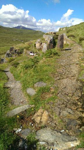
If you step through the eco-gazeebo, on the other side you will find a well made path heading off up the edge of the crag, and a bronze statue of a geologist encouraging you to see where it may lead. Anyone with two functional legs and a moderate amount of fitness can follow from here, but by its very nature the terrain beyond this point is unsuitable for people with mobility difficulties and is absolutely not wheelchair friendly. If you suffer from vertigo you might also want to give this a miss - there are some steep climbs with even steeper drops on one side.

Everybody else, follow me - this is a spectacular journey through time and landscape.
You follow the path along the side of the hill and before long you come across a fork. The right hand fork takes you on the rest of the walk, the left hand takes you down a short dead end where two inscribed slabs give you information about fossilised deep sea worms that can be found here, a few hundred feet above sea level. 
Yet more evidence that the landscape of today is radically different from the landscape of the past.

Make your way back to the main path, and there's another carved stone showing what the worms would have looked like, swishing around in shallow tropical seas so many millennia ago.
 The path leads you through a geological timeline for the rocks in these parts, all the time ever so gently taking you higher and higher. The path at this point is not steep, but the drop to your left does keep getting increasingly pronounced. People with vertigo might want to hang on to a companion, or stare fixedly up the hill at this point - although if heights really are a problem for you be warned - it's only going to get worse from here. Trust me though, the views are unquestionably worth it - they really are spectacular!
As the trail leads you further up the hill you are treated to many features created out of the rock that forms this amazing landscape. If you look up from the timeline section of the trail you'll see a perfectly formed stone sphere constructed in the manner of a dry stone wall. It sits on the side of the hill without explanation. I have no idea what it demonstrates, but it looks extraordinarily cool.
Other - what shall I call them? Exhibits, I guess - are more informative than decorative, although there is a strong and pleasing sense of  design throughout the crag. The two stone hands pictured here illustrate the difference between the sandy coloured rock at the bottom and the grey coloured rock above. Place one hand on each, you are told, and you are spanning three hundred million years of history.

Seriously, where else can you go and hold three hundred million years between your hands? 
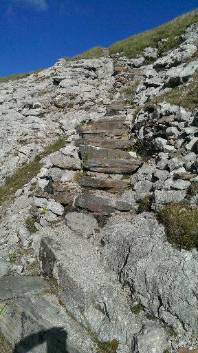
Eventually the path takes you up a steepish set of stone steps. Again, care is required - it's not in any way a difficult climb, but at the same time you need to remember that the consequences of a fall could well involve dropping a few hundred feet to the road below - something which I suspect would be less than fun.
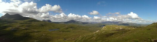
As you climb you'll want to keep your eye on the view though, because the higher you get, the more you can see. Once you reach the top you are rewarded with an utterly spectacular viewpoint offering views across Assynt and Coigach and beyond. Truly spectacular they must be seen to be believed.
I mean, look at it - have you ever seen anything more beautiful? Here you're looking out towards Lochinver with Cul Mor at the far left, the long ridge of Suilven in the distance just to the right of it and Canisp more or less in the middle of the image. Under blue August skies I honestly could have sat there all day watching the shadows of the clouds scoot across the hills and valleys.
From the viewpoint the path takes you along the top of the crag. The views are amazing, but you do become aware that you're at the top of a hill. On the day I was there the wind was blowing pretty fiercely and I was obliged to remove my hat* because if I hadn't it would currently still be flying somewhere in the jetstream.

The path takes you back along the top of the crag until you are more or less above the car park, and then begins to descend. There is one final viewpoint, looking out towards Coigach with the distant hill Stac Polliagh framed once more in the "V" formed by Cul Baeg and Cul Mor.
The flat triangular stone in the foreground of this picture is inscribed with the words of acclaimed Scottish poet Norman MacCaig:
"I don't remember the Eagle going away
but I'll never forget the Eagle shaped space it left
stamped on the air."
   
Reading those words and looking at that view, I could feel the eagle shaped space in the air. Assynt is a wild, wild place and from this vantage point you can really appreciate that without all the hassle of day long walks and cumbersome walking gear.
But it was getting late, so I began the descent back to the car, knowing that the following day we'd be pointing the car towards Coigach and getting deep into that landscape.

*Rather a big thing from my point of view - I am seldom seen without a hat.


Sunday, 9 June 2013

The long narrow road to Dornoch.


I said in an earlier posting that the Altnaharra Caravan Club Site, by the shores of Loch Naver below the clearance village of Grummore was in the middle of nowhere. And so it is. This means that if you want to have a day of shopping you have to be prepared for a bit of a drive. This is, however, not a bad thing because while you will have a long way to go, the landscape you will be driving through is so gorgeous you won't want it to stop.

So it was that when we set out for a day in the coastal town of Dornoch we chose not to take the "quick" route through Lairg and Bonar Bridge, but the "scenic" route via Syre and Helmsdale. You might want to grab a coffee. This will be a longer than usual post, because it is rather a long way...

We left the site and turned right, away from Altnaharra and head in a roughly northerly direction towards the little settlement of Syre. At first the road follows the lochside, and then from the end of the loch it runs along the western bank of the River Naver as it flows relentlessly towards Bettyhill, the north coast, and the sea. As you drive you will pass first the clearance village of Grumbeg - which is also the site of a neolithic chambered cairn - and then the memorial to Donald Macleod, a resident of the cleared village of Rossall, on the opposite side of the river.


In 1857, some years after the clearance, he wrote his experiences up in a series for the Edinburgh Weekly Chronicle. Under the title "Gloomy Memories" these reminiscences were later collected into a book which remains one of the primary sources on the clearances. You can't actually see Rossall from the memorial as it is now obscured by commercial forestry, but we'll come back to it, and to Macleod later.

At around about this point there's also a sign informing motorists that this is now an experimental road surface for timber lorries, and thanking us for our cooperation. Now, we've been driving around this area on and off for more than five years. The sign has always been here, as have the massive timber lorries which hurtle along the narrow roads with careless abandon. In all of that time we've never been able to discern anything experimental about the bog standard tarmac road surface, or managed to work out exactly what it is we've been cooperating with.


After about six miles or so you arrive in the little settlement - I'm going to suggest it's too small to be accurately described as a village - of Syre. There's a little car parking area on your right here, and it's worth pausing for a while to take a look at the church. This neat and tidy little black and white corrugated iron building was constructed in 1901. It was essentially a pre-fab flat pack designed by Spiers and Co. of Glasgow and still hosts services on the second, fourth and fifth Sunday's of the month.


For ourselves myself and Mrs Snail are not church goers, but that doesn't prevent us from appreciating a good church. This little building exudes a sense of calm and tranquillity - a sense that is heightened as you venture inside. The walls are wood lined and white painted, the ceiling a soft sky blue and the pews simple stripped pine. It's surprisingly quiet considering you're sitting inside what is basically a big metal box - although I confess I've never been in there during a hail storm. It's a wonderful little nugget of peace, and I commend it to you.


At the start of the twentieth century people were beginning to move back into Strathnaver after the clearances seventy five years earlier- hence the need for a new church. New crofts were established, but the new settlers hardly had a chance to establish themselves before their young men - so vital on a working croft - were taken by the carnage of Ypre, Paschendale and the Somme, a second tragedy for the valley attested to by the war memorial which stands outside the church.

Behind the church is the house built by Patrick Sellar -who you may remember from the last post as the one time Factor for the Duke of Sutherland and overseer of the Strathnaver clearances, although according to the guidebooks it's been extended and renovated to a point where the man himself wouldn't recognise it.

We need to move on though - turning right just past the church, across the bridge over the River Naver.  If you've set off early and have plenty of time, you might want to turn right again as soon as you hit the opposite shore and take a little detour down the Forestry Commission track. This does mean you're going back on yourself, but if you've developed an interest in the valley - and trust me, you will - there are a couple of things down here that you'll want to see. There's a car park about half a mile down the track, and you'll be on foot from here. Trust me - take a deep breath and stride out into the forest gloom.

You're actually only going to be walking a shade over a mile, but I'm afraid because of your surroundings it will feel like more. don't get me wrong - I really like trees. There are few things I like more than wandering through a forest, the sun streaming through the canopy; dappled shed an fresh, chlorophyll green light. But this isn't that kind of forest. This is a Forestry Commission commercial forest, which means regimented lines of close planted dark green conifers, all standing straighter than a Buckingham Palace guard reaching ever upwards towards an invisible sky. You can't see anything to the side of the track, and you can't see beyond the next bend.

It's like being stuck inside a dark green bubble and you'll be relieved when you get to the little sign that directs you to the left, off the track, and into the lost village of Rossall. You are now more or less opposite the Donald Macleod memorial we passed earlier, although obviously you can't see it because of the trees.

Because of Macleod's book Rossall is probably the most well known of Strathnaver's cleared settlements, and the Forestry Commission has done an excellent job of preserving what's left and providing clear, comprehensive information about what you're actually looking at as you walk through the ruins.

There are the remains of forty seven buildings here, longhouses, outbuildings and kilns for the drying of corn. The settlement is spread across a small hillock, at the summit of which is yet more evidence that human occupation of this valley extends back into more ancient times. The Bronze Age burial mound which sits atop the hill isn't immediately obvious, and I confess I might well have missed it had we not been in possession of the excellent little book "What to see in Strathnaver: A guide to local history and Archaeology" by Kevin O'Reilly and Ashley Crockford which we picked up from the information centre in Bettyhill a couple of years ago.

Rather more obvious evidence of ancient occupation can be found if you leave Rossall, return to the Forestry Commission track and head about a mile and a half further on down. Be warned - it will feel very much like walking through a painting by MC Esher, the track does seem endless beneath the miserable conifer canopy where the sun does not shine and the birds seem not to sing, but you will be rewarded at the end of it with Clach an Righ, a small circle of standing stones.


In common with so many of the standing stone monuments in the north of Scotland, there is a refreshing lack of barriers here. If you've ever been to Stonehenge on Sailsbury Plain you'll know that you can't get within twenty feet of the stones. Now, while I confess that Clach an Righ is a lot less spectacular than Stonehenge, there is nothing stopping you getting up close and personal with the monument and feeling the history which radiates from the rock.

The legend is that this circle - about twenty two feet across - it's slender stones protruding snaggle toothed from the scrubby ground was raised to commemorate the Battle of Dalharrold, between Scots and Norsemen at the tail end of the Twelfth Century. Given that people of that time were not given to arranging rocks in circles such an explanation is clearly nonsense, and indeed the archaeology suggests that the stones are significantly older.

How old is a matter of some speculation, but it could easily date back to 2000BC*, meaning that this little circle of stones could pre-date the Broch mentioned in the last post by as much as two thousand years, and suggest that there have been people in the Strath for four millennia. The purpose of these circles is unknown, although the presence of a small cairn within the ring points to the possibility of a burial here.

If you've walked all this way though, you'll realise as we did that however fascinating is is to commune with the ancients, time will be getting on, it's a long walk back to the car and you'd better get a shift on if you're going to get to Dornoch by lunchtime. For the sake of brevity, and because it's a hideous walk I choose not to think too much about, I'll omit any description of the two and a half mile trudge back to the car and instead leap forward to skimming across an almost deserted landscape along the single track road** which will lead us eventually to the eastern coast of Scotland.

You're a few miles down the road before you come to the first landmark, the The Garvault Hotel, which claims - with some justification - to be the most remote hotel in mainland Britain. We've never visited, what with hotels not being our thing, but I can confirm that it is truly in the middle of nowhere, and that it is set in the middle of an empty and dramatic landscape. Indeed, it's gone the extra mile in terms of isolation by being set at least half a mile back from the road. The place has always appeared deserted, but then I guess that's the point.

A few miles further on you start tom come across isolated farms and the landscape begins to change subtley. The orange and russets of moorland begin to give way to greener, grassier, more rolling hills - particularly once you take a hard right hand turn onto the A897 at the little village of Kinbrace. (A left hand turn here will take you to the wonderful Forsinard Flows, about which more at some time in the future.) You'll notice more trees, of a more deciduous nature and for the most part you find yourself at a much lower altitude, no longer looking down on the river at the bottom of the valley but driving at more or less the same level as the fly fishermen standing up to their waists in their quest to land the biggest salmon.

You have to drive with a little extra caution around here. It's easy to get used to the wide open spaces where you can see for miles ahead and - even on these single track roads - you can belt along at a pretty fair old clip. As you get closer to the East Coast the proliferation of trees makes it much harder to see what's coming. While it's true that there aren't all that many cars on the road, there are some, and besides cars aren't the only thing you might meet on the road.


Red Deer are remarkably prolific in this neck of the woods and for some reason up on the moors where you can see them easily they stay well away from the road but as soon as you get a lot of trees to obscure your view they come right up to the road. Maybe they're all car spotters, I dunno. Still, a bit of cautious driving means you stand an excellent chance of getting a really close up view, while being profligate with your speed makes it rather likely you'll hit one - and you wouldn't want to do that. Really, you'd feel bad about it. Besides, have you seen them? Adult Red Deer are huge! Hit one in anything smaller than a tank and you're definitely going to write off your car.

Finally you drive over the Kildonan Beck, where there is a helpful display of information about the gold rush of 1869. Everything here is green and peaceful now, but back in the latter half of the nineteenth century this section of the Helmsdale valley was occupied by a dense little shanty town known as "Baile an Or" in Gaelic - "Village of the Gold" in English. There still is gold in these thar hills, and you can still pan for it. (There are rules though, so a little research is required before you start.) You're unlikely to get rich, but there is a heart warming story in the Timespan Museum in Helmsdale about a bloke who panned the stream for years until he had enough gold to make a wedding ring.

Then, suddenly, you're in Helmsdale. The town just seems to suddenly appear - the single track road broadens out to the more standard two lane arrangement and ordinary suburban houses on either side of the road. After such a long drive through such emptiness Helmsdale feels like a major conurbation, although it really is - by Southern standards at least - quite tiny. It's a pleasant little place, but one I won't describe now because we'll be back in the not too distant future.

From here we pointed the car south on the A9 - one of the few A roads in this neck of the woods which isn't single track, and consequently feels a bit like a motorway - through the towns of Brora and Golspie towards Dornoch and much more importantly, lunch.

About which, more soon.


*Or BCE is you prefer more PC dating.

**Not that the road being single track is remarkable in any way - all the roads are single track around here.